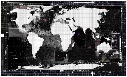
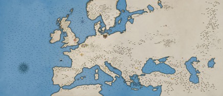
BBC History Magazine : 20th Century Violence . double-page spread illustrated world map
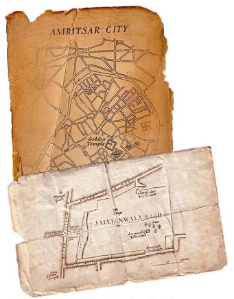
BBC History Magazine : The Amritsar Massacr 1919
Geographical Magazine : cover illustration - Burke and Wills fatal expedition, Australia 1860
Penguin Books : 'Kings of the Realm : War's Harvest' by Oisin McGann
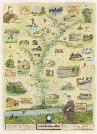
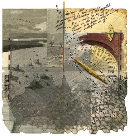
Private Commission : History of Fly Fishing on the River Test
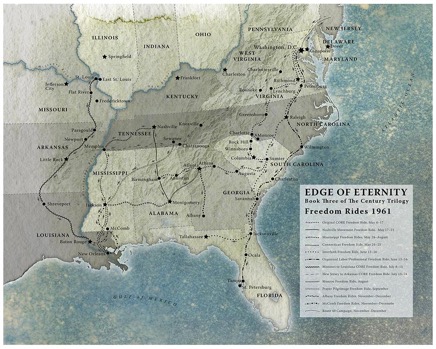
Random House Penguin US : 'Edge of Eternity' by Ken Follett . endpapers illustrated map
BBC History Magazine : Brunel and the building of the Great Western Railway 1843
The Royal Armouries : Floor illustrated map (artwork 12x5 metres) for 'Field of the Cloth of Gold' exhibits including Henry VIII suit of armour etc.
Historical Illustrated map for a 1st Gulf War US veteran, Paul Christian. Paul was so badly injured that he is now confined to a wheelchair. Heat scans of his backside pressure-points came up with a map-type image, so commissioned Hand Made Maps to produce a pirate map artwork...
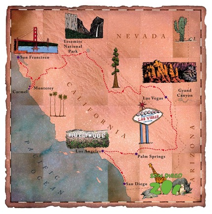
Daily Telegraph and Virgin Holidays : Touring route map of California and Nevada
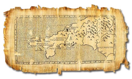
The Times Weekend Supplement : Jesus in Cornwall
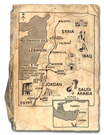
Lonely Planet Magazine : Tourist Destinations in Syria and The Lebanon
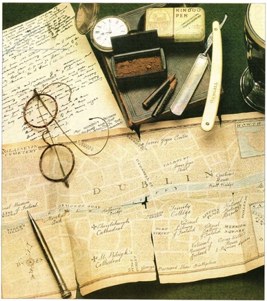
The Guardian : 100th Anniversary of 'Bloomsday' and James Joyce's 'Ulysses'
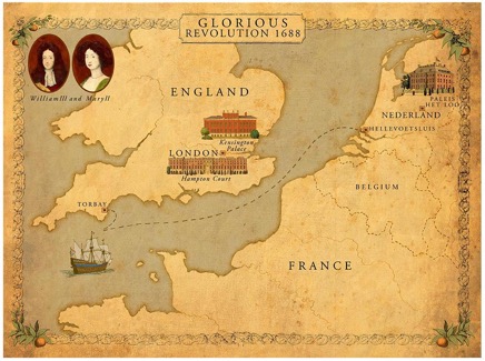
Kensington Palace Education Department : The Glorious Revolution 1688
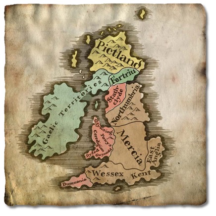
BBC History Magazine : illustrated map of Anglo-Saxon Britain
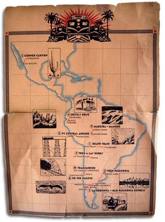
Wanderlust Travel Magazine : South American Rail Journeys
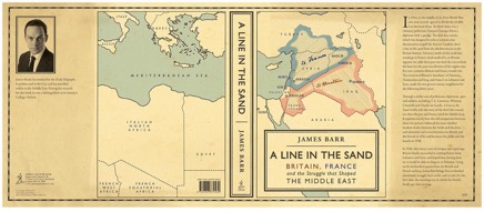
Simon and Schuster : 'A Line in the Sand' by James Barr . map artwork for dust-jacket
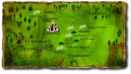
The Royal British Legion Magazine : The Somme 1916
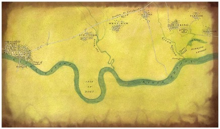
DesignMap | Eastbury Manor Exhibition : London to Barking river journey in the Middle Ages historical map
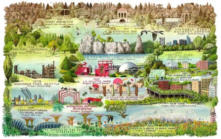
The Landscape Institute : 'Landscape' Magazine . the history of the urban parks, illustrated mind map
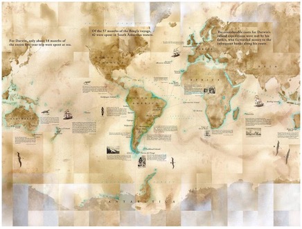
DesignMap | Charles Darwin Museum, Down House, Kent . The Voyage of the Beagle illustrated map mural
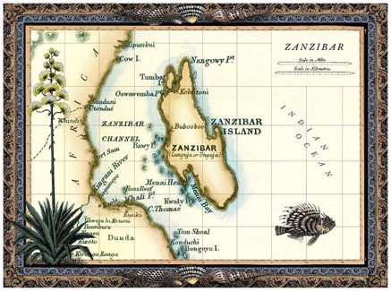
Adworks Advertising, Sydney : Victorian Map of Zanzibar
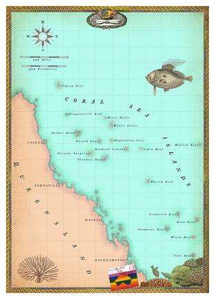
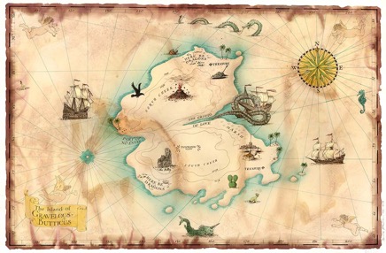
The Coral Islands . 'The Curious Atlas' . Elwin Street Ltd
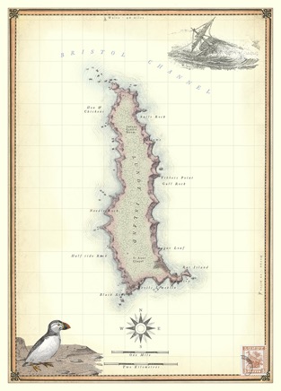
Lundy Island . 'The Curious Atlas . Elwin Street Ltd